| CATEGORII DOCUMENTE |
| Bulgara | Ceha slovaca | Croata | Engleza | Estona | Finlandeza | Franceza |
| Germana | Italiana | Letona | Lituaniana | Maghiara | Olandeza | Poloneza |
| Sarba | Slovena | Spaniola | Suedeza | Turca | Ucraineana |
Destinator DG User Manual

Destinator Technologies
Introduction 3
Destinator DG Features3
Tutorial3
Getting Started 4
What's on the Map?4
GPS Not Found5
Map Views.5
Point on the Map.6
Menus..7
Screen Buttons.9
Cycling through Screens..10
Search for a Location 11
Enter Address.11
Recent Locations..14
My Favorites..15
POI (Points of Interest).18
Route Overview or Cancel Route20
Turn-by-Turn List21
Select Map..22
Plan a Trip 23
Multistop Planner.23
Avoid Roads..25
Route Playback.27
Map Browsing27
Settings 28
Map.28
Quick Navigation.29
GPS Settings..29
Prompts.30
Units of Measure..31
Tutorial Settings31
About.31
Help.31
Installation Requirements 32
PC Requirements.32
Installing the Console32
Console Toolbar33
Technical Support33
Maps 34
Map Screen Interface.34
Installing a Map34
Map Cutter Screen Interface..35
Focus the Map36
Cut Map38
Load Map.38
Remove Map..38
Importing a Favorite 39
System Settings 41
Volume Settings42
Power Settings..42
Backlight Settings42
Date-Time Settings.43
Language Settings43
System Information.43
Index 44
1 - Introduction
Welcome to the world of mobile navigation! Your Destinator device provides a full-featured mobile satellite navigation system. Gone are the days of taking out the map. You can now select an address or a predefined point of interest and request your navigation device to create a route.
Destinator DG Features
Destinator provides the following features for easy navigation:
Lets you differentiate between car and pedestrian navigation
Able to install and use your navigation device in minutes
Full screen 2D/3D day and night maps with precise voice guidance
Able to quickly create a route for any distance
Cross border navigation without switching maps
Intuitive menus and touch-screen buttons for easy input
Instant address retrieval from recent locations, favorite destinations, or POIs
Planning routes that include stopovers
Avoid toll roads, congested roads, or roads through dangerous areas
Provides traffic messages alerts (Optional)
A wide selection of maps from all over the world
A choice of over 10 languages
Attractive map and screen format
Totally portable, and can be used in a vehicle or by a pedestrian, during your daily commute or on vacation
Destinator Guide Tour
|
|
From the Settings menu, you can tap the Tutorial button to open the Destinator Guide Tour program. The Guided Tour is an excellent way of becoming familiar with the different navigation features available. |
2 - Getting Started
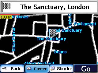
What's on the Map?
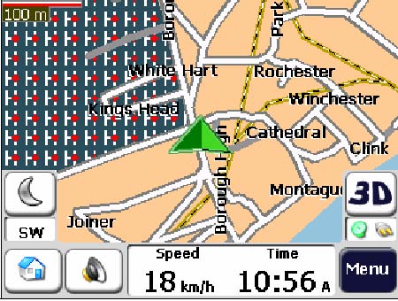
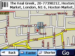
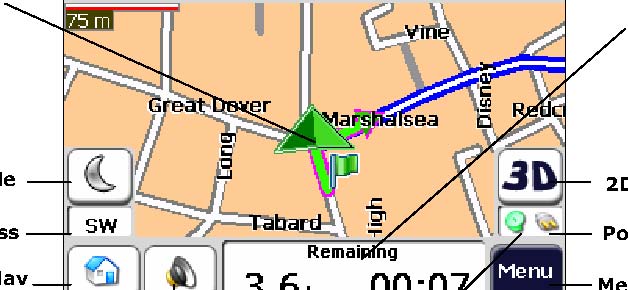
When you first turn on Destinator, the Main Map screen appears. You can use the icons displayed on this screen to plan and view your route.
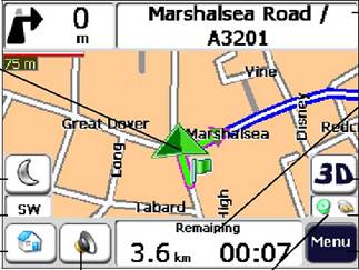
Figure 1 - Map Screen
|
|
Your current location in Vehicle Mode. Your last known location when GPS signal is unreliable. |
|
|
The generated route. |
|
|
Your selected destination. |
|
|
The Compass displays the travel direction. |
|
|
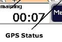
Displays the GPS status. The red GPS receiver
The green GPS receiver
|
|
|
These icons display your power source, electricity
|
|
|
The GPS bar is a toggle button that displaysthe remaining travel distance and travel time, estimated time of arrival, and speed and altitude, and street name and address number. |
|
|
When you have calculated a route, the Directions bar displays information about your next turn. Click this bar for a complete list of turn-by-turn directions. |
Current Location
Day/Night Mode
Compass
Quick Nav
GPS-Generated Information
2D/3D Mode
Power Indicator
Menu Button
GPS Status
Volume
Directions Bar


![]()


![]()
GPS Not Found
When you first start your navigation device, you will hear the message Signal too low. This message means that your navigation device hasnt yet located a reliable GPS signal. Check that your device is connected and has a clear view of the sky. If after five minutes, you have not located a reliable signal, go to the Technical Support section on page 33.
Please check that:
The GPS antenna is extended or flipped up.
The device has a clear view of the sky for uninterrupted GPS reception. Destinator cannot calculate the route if there is no GPS reception (for example, in a tunnel).
The navigation device is charged or connected to the cigarette lighter.
Map Views
You can determine whether you want to see a two-dimensional or three-dimensional map in daylight or nighttime conditions.
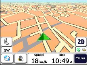
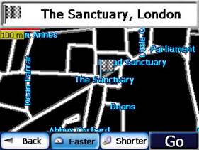
The 2D Day Mode View is optimized for a daytime viewing. 2D views let you manually pan or zoom. For an example, refer to Figure 2 - 2D Day Mode Map View.
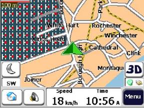
The 2D Night Mode View is optimized for night driving or adverse weather conditions. For an example, refer to Figure 3 - 2D Night Mode Map View.
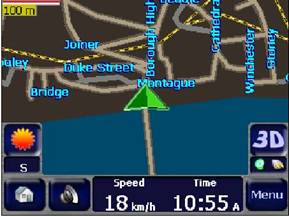
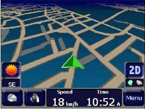
The 3D Mode Day View or Night View provide you with a three-dimensional map for day or night driving. For an example, refer to Figure 4 - 3D Day Mode Map View and Figure 5 - 3D Night Mode Map View.
From the Options menu, click the 3D
Mode
![]() button to view a three-dimensional map. If
the map already appears in three-dimensions, 2D Mode
button to view a three-dimensional map. If
the map already appears in three-dimensions, 2D Mode
![]() is displayed on the toggle button. You can
click the Night Mode
is displayed on the toggle button. You can
click the Night Mode

![]() button to display the map in night conditions.
If the map already appears in night mode, Day Mode
button to display the map in night conditions.
If the map already appears in night mode, Day Mode

![]() is displayed on the toggle button.
is displayed on the toggle button.
|
Figure 2 - 2D Day Mode Map View |
Figure 3 - 2D Night Mode Map View |
|
Figure 4 - 3D Day Mode Map View |
Figure 5- 3D Night Mode Map View |
Point on the Map
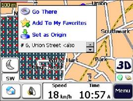
You can navigate to any point by tapping its location directly on the Map screen. This feature is especially handy when you want to navigate to a specific point on the map, but you dont have the street address. When you tap on the map, the context menu appears.
|
|
Navigate This button lets you calculate a route from the map point. |
||
|
|
Favorites This button lets you save a point on the map as a favorite destination. This is helpful if you see a location that you want to return you later. |
||
|
|
Set as Origin This button lets you designate the selected point as the starting point and not the designation. This is helpful when you want to calculate a route from a point other than your current location. |
||
|
|
|||
Figure 6 - Point on the Map Options
Menus
You can press the Menu

![]() button from the Main Map screen to
display the three main Destinator menus, as shown below.
button from the Main Map screen to
display the three main Destinator menus, as shown below.
|
|
|
|
Figure 7 - Destinator Menus
The More

![]() button lets you cycle through the Destinator
DG menus.
button lets you cycle through the Destinator
DG menus.
You can click the Map

![]() button to return to the Main Map
screen or the Quit
button to return to the Main Map
screen or the Quit

![]() button to close the Destinator DG
Navigation System.
button to close the Destinator DG
Navigation System.
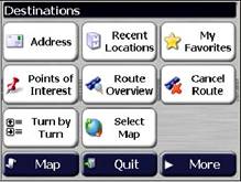
Destination Menu
This menu provides the following options:
|
|
The Enter Address button lets you navigate to an address, as described in 'Enter Address' on page .11 |
|
|
The Recent Locations button lets you navigate to a previously visited destination, as described in 'Recent Locations' on page 14. |
|
|
The My Favorites button lets you navigate to a favorite location, as described in 'My Favorites' on page 15. |
|
|
The Points of Interest button lets you navigate to thousands of interesting places, such as beaches, parks, hotels, museums, and restaurants. For more information, see 'Points of Interest' on page 18. |
|
|
The Route Overview button lets you display your complete route on the Map screen. This button is disabled when no route exists. |
|
|
The |
|
|
The Turn-by-Turn button lets you display the complete, step-by-step directions to your destination. For more information, see 'Turn-by-Turn' on page 21. |
|
|
The Select Map button lets you choose among different maps on your memory card. For more information, see 'Select Map' on page 22. |
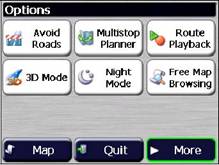
Options Menu
This menu provides the following options:
|
|
The Avoid Roads button lets you avoid a road type, such as toll roads or selected streets, as described in 'Avoid Roads' on page 25. |
|
|
The Multi-Stop Planner button lets you designate several stops on a route, as described in 'Multi-Stop Planner' on page 23. |
|
|
The Route Playback button lets you record your route and play it back later. For more information, see 'Route Playback' on page 27. |
|
|
The 2D/3D Mode toggle button lets you display the map view in 2-dimensional or 3-dimensional views for either day or night driving. For more information, see 'Map Views' on page 5. |
|
|
The Day/Night Mode toggle button lets you display the map view for either day or night driving. For more information, see 'Map Views' on page 5. |
|
|
The Map Browsing button lets you browse the map unconnected to the current location. In this mode, the GPS system is not used. Your current position is not detected and Destinator DG does not keep track of your driving progress. |
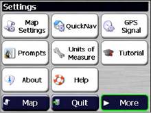
Settings Menu
This menu provides the following options:
|
|
The Map Settings button lets you specify map orientation, font, and zoom features. For more information, see 'Map' on page 28. |
|
|
The Quick Nav Settings button lets you specify an address or place to which you can navigate with a single tap on the Quick Nav button. For more information, see 'Quick Navigation' on page 29. |
|
|
The GPS button lets you configure the GPS settings. For more information, see 'GPS Settings' on page 29. |
|
|
The Prompts button lets you specify the types of voice or visual prompts that you want to use. For more information, see 'Prompts' on page 30. |
|
|
The System button lets you specify the system measurement units and provides About information. For more information, see 'Units of Measure' on page 31. |
|
|
The Tutorial button lets you open the Destinator Guide Tour program. The Guided Tour is an excellent way of becoming familiar with the different navigation features available. |
|
|
The About button lets you display Destinators version and copyright information. |
|
|
The Help button opens the Destinator DG help file. |
Screen Buttons
The following buttons appear on many of the navigation Destinator screens.
|
|
When you tap the Next button for a selected address, group, or place, Destinator automatically opens the next screen in the sequence. After you have specified your destination, tap the Next button to display a map screen showing your selected location. This map lets you determine a route type and provides a GO button, which instructs Destinator to calculate the route from your current location to your selected destination. |
|
|
When you tap the Back button, Destinator returns you to the previous screen. |
|
|
When you tap the GO button, Destinator calculates the route to your selected destination. |
|
|
The Actions button provides a list of command options available for the selected address or place. |
|
|
The Hide/Display Keyboard toggle button lets you show or remove the keyboard. |
|
|
The Save, OK, or Done buttons confirm your value preferences and returns you to the menu or map. |
Cycling through Screens
Every navigation function in the system, such as Address, POI, or My Favorites consists of a sequence of screens. You can cycle through the screen sequences by either:
Selecting an item from the list and tapping it.
Selecting an item form the list and tapping the Next button.
The sequence ends with the Show on Map screen, where the destination is displayed and the GO button is available for you to calculate a route.
You must first select an item from the list to cycle through the screen sequence, and for the Actions, Next and Back buttons to be enabled.
3 - Search for a Location
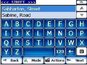
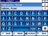
Enter Address
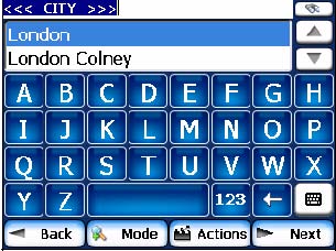
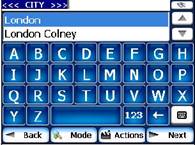
When you click the Address button, the Address screen appears, as shown below.
|
|
|
|
|
Figure 8 - Display the Address Screen
You can use the keyboard to enter the first characters of the address name. The characters appear in the Address field. Destinator automatically searches the Address list for the first occurrence of the entered characters. After you have selected a city, Destinator displays the next address field, such as street and address number.
You can also tap the Next button to move through the sequence of address screens.
The following command keys are available to enhance your search process:
|
|
If the automatic search feature does not find your specified name, use the Find button to conduct a sub-search, particularly useful when the address name consists of two or more words. |
|
|
The Scroll buttons let you move up or down the list of address items, such as city or street names. |
|
|
The Hide/Display Keyboard toggle button lets you extend or shorten the address list by hiding or displaying the keyboard. |
|
|
The Select key lets you display lowercase and numeric characters. |
|
|
The Erase key lets you delete the last character in an address field. |
You can change your address search method by tapping the Mode button to select from a variety of address formats, as described in 'Address Modes'.
Note: If the entered characters are not found at the beginning of the name in the Address list, the Smart Search System automatically searches for the entered characters throughout the entire list, for example, in the middle or the end of the name.
Destinator lets you search for city and street names without having to enter accent marks (umlauts), which are used in many European languages.
Address Modes
You can define the information used to locate an address by tapping the Mode button. Destinator provides a variety of address formats, as described below.
|
City-Street |
This sequence displays the following address screens: City, Street, Address Number You can also navigate to city or street only. When
you have selected a city, the first entry of the Street Name list is City-Street is the default format. |
|
Street-City |
This sequence displays the following address screens: Street, City, Address Number Lets you enter a street name without having to first designate a city. Useful when you're looking for an address in a metropolitan area where there are many cities and towns. |
|
Cross-Street |
This sequence displays the following address screens: City, Street 1, Street 2 Lets you locate an intersection by entering the names of two intersecting streets. |
|
Zip Code |
This sequence displays the following address screens: Zip Code, Street, Address Number This mode lets you locate a street address by entering the zip code, without entering a city name. Useful when you have no city information or if the city has multiple zip codes. |
|
In Other Maps |
You can select another map of a country that you can travel to by vehicle. This feature is available only when you have the following maps installed: Another map of countries on the same continent as the selected map The map of the major roads for the continent
that connects one map to another (for example, the major roads of For example, if you are in |
Address Actions
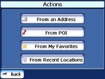
When you have specified an address, tap the Actions button to select from the following commands:
|
Set as Origin |
Lets you designate the selected address as the route origin. Use this command when calculating a route from a point other than your current location. The navigation device displays the selected location as a starting point only for a few seconds before returning you to your current location. Note: You are still receiving the GPS signal. |
|
Show on Map |
Lets you see the selected address on the map. |
|
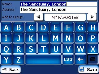
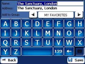
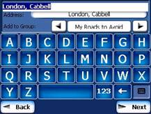
Add to My Favorites |
Lets you add an address to your list of favorite locations, as shown in the figure below. For more information, see 'My Favorites' on page 20.
Figure 9 - Add Address to My Favorites |
|
Information |
Displays the locations address information. |
Go to your Destination
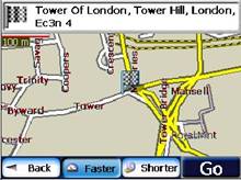
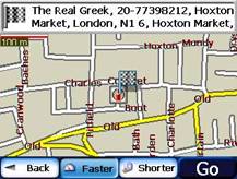
After you have specified the address, tap the Next button. Destinator shows your destination on the Map screen before calculating a route. Check that the destination address is correct at the top of the screen. If you want to change the destination, tap the Back button and change your address entries.
|
|
|
|
Figure 10 - Calculate your Destination
If the destination is correct, you can instruct Destinator how to calculate your route by tapping either the Faster or Shorter button, as described below.
|
|
This option selects the route that takes less time. Faster is the default value. |
|
|
This option selects the route that is the shorter distance. Remember, the shorter route may not always be the quickest, as you are able to travel faster on some roads than on others. |
Note: Route generation does not take into account any detours, stops, or delays along the route.
When you are ready, tap the GO button to create a route to your selected destination.
Recent Locations
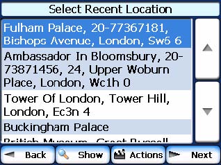
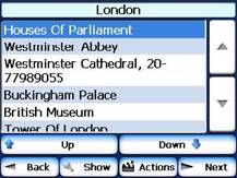
The Recent Locations screen lets you select an existing destination from a list of destinations that you have previously traveled to. Destinator automatically stores the last 64 destinations in memory. As each new route is added to the top of the list, the older destinations at the bottom are erased.
To navigate to a recently-traveled destination, tap the Recent Locations button. From the Recent Locations screen, select a location and tap the Show or Next button. A map appears showing the specified location. Tap the GO button to calculate the route.
|
|
|
|
|
|
Figure 11 -Traveling to a Recent Location
From this screen, you can tap the Actions button to select from the following commands.
|
Set as Origin |
Lets you designate the selected address as the route origin. You would use this command when calculating a route from a point other than your current location Note: You are still receiving the GPS signal. |
|
Add to My Favorites |
Lets you add an address to your list of favorite locations. For more information, see 'My Favorites' on page 20. |
|
Delete Item |
Lets you delete a recent location. |
|
Clear List |
Lets you clear all locations in the Recent Locations screen. |
|
Information |
Displays the locations address information. |
My Favorites
A Favorite is a destination that you have stored for easy retrieval.
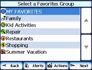
To access a favorite destination, open the Destinations menu and tap the My Favorites button. The My Favorites screen displays your favorites groups. When you tap on a selected group, Destinator automatically displays its stored locations. Tap the selected location to show your destination on a map. Tap GO to calculate your route.
|
|
|
|
Figure 12 - Travel to a Favorite Location
Note: The My Favorites folder is the default folder where all favorites are stored if not assigned to a group.
The Show Map screen also lets you set your route type, Faster or Shorter. For more information, see 'Go to your Destination' on page 13.
Favorite Groups
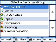
You can tap the Actions button from the My Favorites screen to add, edit, or delete groups, as described below.
|
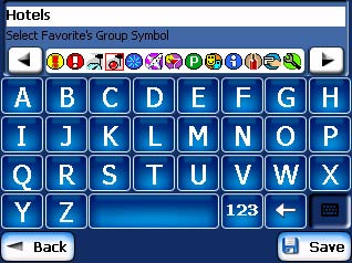
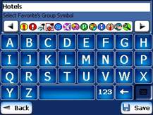
Add Group |
When you tap this button, the Favorites Group screen appears. Enter the group name and select an icon to identify the group, as shown below.
Figure 13 - Create Favorites Group The icon identifies all destinations located in that group, as displayed on the map. |
|
Edit Group |
When you tap this button, the Favorites Group screen appears with the name and selected image of the highlighted group. You can change the name and icon. |
|
Delete Group |
When you tap this button, the selected group and its associated entries are removed. The My Favorites group cannot be deleted. |
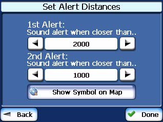
Favorite Alerts
Alerts let you know that you are within a certain distance of a favorite location.
You can tap the Alerts button to set the distances for the 1st and 2nd Alerts. When you travel closer than the designated distance, the alert will sound, as shown below.
|
|
|
Figure 14 - Setting Your Favorite Alerts
Examples:
You have a group called Shopping that includes all of your favorite stores. An alert appears on the screen when you are closer than the designated distance to the stores in your group, providing an opportunity to consider whether you would like to stop and shop.
You have a group called Projects that include addresses of your bank, grocery store, garage, hardware store, doctors office, post office, and so on. When the alert is set, Destinator reminds you about these places when you come within close proximity to them.
You are going on a trip and friends have recommended certain restaurants that are on your route. You can create a group called Restaurants and enter the restaurant addresses. As you take your trip, an alert will go off when you come within range of these restaurants.
Notes:
Favorite Alert settings affect all Favorites Groups.
The 2nd Alert must be set to go off at closer distance than the 1st Alert.
Alerts can be set for a group but not for individual locations. Of course, you can always create a group that has just one location.
You can disable the alerts for all groups by selecting the 1st Alert setting to Off.
You can disable the alerts for a particular group by selecting the group and tapping the Hide Symbol on Map button. Disabled alerts are identified by a red diagonal line through the symbol.
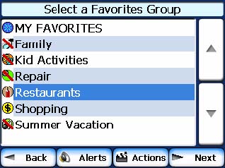
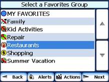
Figure 15 - Disabled Favorite Alerts
Activate that disabled alert by selecting the group and tapping the Show Symbol on Map button.
Add Favorite Locations
Tap MY FAVORITES or any selected group that you have created to display its locations. You can save a location to your favorites groups from the Address, Recent Locations, or POI screens. For more information, see 'Add to Favorites' on page 13.
From this screen, you can tap the Actions button to display the following commands.
|
Set as Origin |
Lets you designate the selected location as the route origin. You would use this command when calculating a route from a point other than your current location. Note: You are still receiving the GPS signal. |
|
Show Map |
Lets you see the map with the selected favorite destination for you to review before creating a route. |
|
Edit Favorite Location |
Lets you change the name, comment, or group location for the selected location. |
|
Delete Favorite Location |
Tap the button to remove the selected location. |
|
Information |
This button displays additional address information, such as address details, phone number, and other comments about your favorite location that you have entered. |
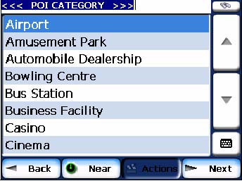
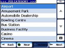
POI (Points of Interest)
The POI list is a collection of hundreds of interesting or useful places organized by easy-to-find categories. For example, you can use Destinator to guide you to a mall, hotel, restaurant, or gas station.
From the Destinations menu, tap the Points
of Interest button. The POI screen appears. You can find a category
by tapping the Hide/Display Keyboard

![]() button and entering text in the POI
Category field. The Smart Search System automatically displays the POI
categories that match the characters entered.
button and entering text in the POI
Category field. The Smart Search System automatically displays the POI
categories that match the characters entered.
If you didnt find the category through the
initial search you can also use the Find

![]() button to do a sub-search, particularly
useful when the category name consists of two or more words. You can always
browse the POI Category list by using the Browse buttons.
button to do a sub-search, particularly
useful when the category name consists of two or more words. You can always
browse the POI Category list by using the Browse buttons.
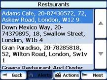
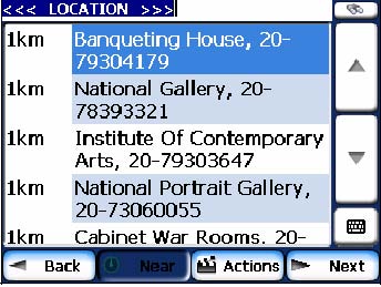
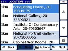
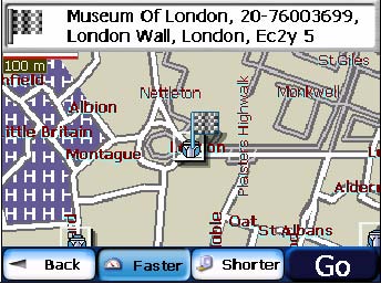
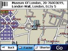
When selecting a category, Destinator automatically displays the category entries and the distance each entry is from your current position. Select your entry and tap or click the Next button to display your selected destination on the map and then tap GO to calculate your route. From the Show on Map screen, you can designate a route type, Faster or Shorter. For more information about calculating a route, see 'Go to your Destination' on page 13.
|
|
|
|
Figure 16 Points of Interest
Note: From the Item Entries Actions screen, click the Sort by ABC button to display the category entries in alphabetical order.
Subcategories
Many categories have subcategories to provide for an even greater list of choices. For example, Gasoline Station may have many subcategories each representing a particular brand name. The same is also true for Hotels. Restaurants have subcategories that represent different types of food, such as American, Italian, and French, as shown below.
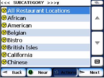
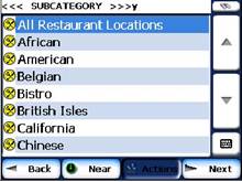
Figure 17 - POI Subcategories
Search Near a Location
You can tap the Near button to determine the location area, where you want to search for a specific place, such as a gas station, hotel, or restaurant.
The available options are listed below.
|
Current Location |
Lets you search near your current location. This is the default value. |
|
Destination |
Lets you search near a specified destination. For example, you know your general destination, but not very much about interesting locations in the area. You can use Destinator to locate the tourist attractions most appealing to yourself, family, or friends. Note that this button is enabled only when a destination is entered. |
|
Other Address |
Lets you search near another address. For example, you have set a destination, but on the way you want to stop at another location. You can use this feature to search near that location for restaurants, lodging, historical sites, or anything you want. |
|
Search Radius |
Enter the location distance to search for a designated place. For example, if you enter 5 km, Destinator only searches within a five kilometer radius. When you select a large search radius, you risk the chance of finding too many locations, which makes it harder to find the place that you are searching for. It is best to start with a small search radius size, and then make it larger if necessary. Note: if you dont specify a search radius, Destinator searches the whole map. |
|
Show or Hide Symbol on Map |
Lets you customize your POI list by showing or hiding the POI category symbols that you dont want. When you hide a category a red mark appears. This mark only means that the category symbol does not appear on your map. The category locations are still available to you. You can always show a hidden category symbol by selecting the category and tapping the Show Symbol on Map button. |
Actions
When you have selected a POI location, tap the Actions button to display the commands listed below.
|
Set as Origin |
Lets you designate the selected location as the route origin. You would use this command when calculating a route from a point other than your current location. Note: You are still receiving the GPS signal. |
|
Show on Map |
Lets you show the map with the displayed destination for you to review before creating a route. |
|
Add to My Favorites |
Lets you add a POI entry to your list of favorite locations. For more information, see My Favorites on page 20. |
|
Sort By ABC or Distance |
Lets you sort the entries of the selected category alphabetically or by distance from your current location. Note: Destinator initially displays the entries by distance. |
|
Information |
Displays the telephone number and address information, and all other information the system has regarding the selected POI entry. |
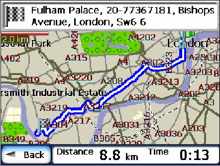
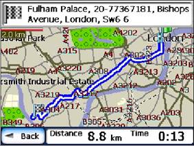
Route Overview or Cancel Route
The Route Overview
![]() button lets you display an overview of your
complete route on the Map screen, the total driving distance to your
destination, the estimated travel time, and the complete destination address.
button lets you display an overview of your
complete route on the Map screen, the total driving distance to your
destination, the estimated travel time, and the complete destination address.
Figure
The 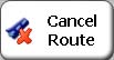
![]() button stops the current navigation and
clears the route. This feature is active only after a destination has been set.
button stops the current navigation and
clears the route. This feature is active only after a destination has been set.
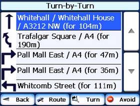
Turn-by-Turn List
After you have entered a destination and calculated a route, the Directions bar appears at the bottom of the Map screen, displaying the following information:
The next turn direction
The distance to the next turn
The street name of the next turn
When you tap the Directions bar or click
the Turn-by-Turn

![]() button, Destinator displays a complete
set of turn-by-turn directions from your current point to your selected
destination.
button, Destinator displays a complete
set of turn-by-turn directions from your current point to your selected
destination.
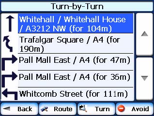
Use the Scroll buttons to move up or down the directions list.
|
|
|
Figure 19 - Display Turn-by-Turn
The following options are available:
|
|
The Route Summary button displays your entire route on the Map screen, plus the travel distance and the Estimated Travel Time Remaining (ETR). |
|
|
The Show Turn button displays the next turn on the Map screen, including the street name, the distance to it, and the turn direction. |
|
|
The Avoid button lets you avoid the selected turn in the directions list. Destinator recalculates the route automatically. Note that when you exclude a turn, the recalculated route may take longer. |
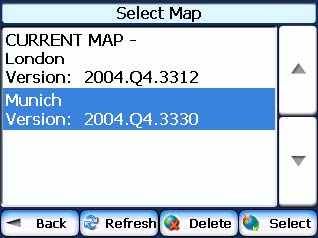
Select Map
This feature lets you change the currently selected map to another map saved on your SD memory card. If you want to store additional maps on your memory card, see Maps on page 34
You can tap the Select Map button from the Options menu to display the maps saved on your SD memory card. The Select Map screen displays map details and version numbers. The map currently used appears at the top of the list.
|
|
|
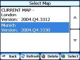
Figure 20 - Select a Map
The following Select Map commands are:
|
Select |
Lets you designate a selected map as the current map. |
|
Delete |
Lets you permanently remove a selected map. Note: You cannot delete the current map. |
|
Refresh |
Lets you refresh the screen when a new memory card is inserted into the device. |
4 - Plan a Trip
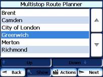
Multistop Planner
The Multistop Planner lets you plan a route with up to twelve stops.
When you press the GO button, the route is calculated in stages, from the departure point to the first stop. When you reach the first stop, the route recalculates to the second stop, and so on.
|
|
|
|
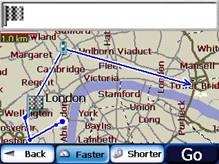
Figure 21 - Travel to Multiple Routes
The Show on Map screen provides you with the following route types: Faster and Shorter. You can select Shorter to calculate a route with the shorter physical distance between your current location and the selected designation. When you tap the GO button, Destinator automatically calculates the faster route.
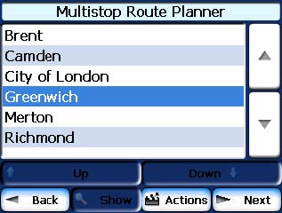
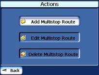
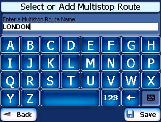
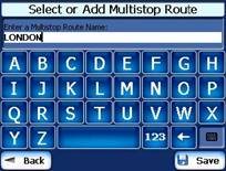
Defining Route Groups
From the Multistop Planner screen, select the Actions button and tap Add Group. From the Add Group screen, enter the Group name and save. The Actions screen also lets you edit or delete a selected group.
|
|
|
|
Figure 22 - Defining the Route Group
Setting Stops along the Route
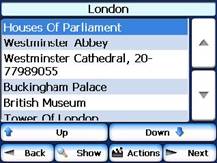
You can set up stops by selecting the Route Group and tapping the Next button. From the Stops screen, tap the Actions button to add, rename, or delete a destination.
Add a stop by Address, POI, My Favorites, or Recent Locations. Select one of these options, specify a location, and click the OK button. The Add Stop screen appears. You can change the location name, enter a comment, or designate a different group. When youre done, tap Save.
|
|
|
|
Figure 23 - Specifying a Stop
When in the Stops screen, you can use the following commands:
|
|
You can use the Move Up or Move Down buttons to change the order of your itinerary. |
|
|
Shows the stop destination on the map and lets you select a route type, Faster or Shorter. Tap GO to calculate the stop destination. |
|
|
Select the Show button to view the selected stop destination on the map. |
Stop Actions
You can tap the Actions button for the following command options:
|
Set as Origin |
Lets you designate the selected address as the route origin. You would use this command when calculating a route from a point other than your current location. Note: You are still connected to the GPS signal. |
|
Add Stop |
Lets you add a location by specifying an address from recent locations, favorite locations, or pre-defined POIs, such as fuel, food, or lodging. |
|
Rename Stop |
Lets you change the stop information, such as name, comments, or route group. |
|
Delete Stop |
Lets you remove a selected stop. |
|
Optimize Route |
Your trip itinerary is created by the sequence of stops entered. This may not be the most efficient route. When you click Optimize Stops, Destinator changes the order of stops to create the most efficient route. |
|
Information |
This button displays the locations address information. |
Avoid Roads
You can specify that certain roads be permanently excluded from your route calculations. Use this feature when you want to avoid congested boulevards, toll roads, or unsafe streets.
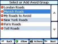
From the Destinations menu, tap the Avoid
Roads button. The Avoid Roads screen appears, displaying the Toll
Roads and
|
|
|
|
|
Figure 24 Creating Avoid Road Groups
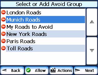
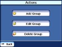
Avoid Road Groups
From the Avoid Roads screen, tap the Actions button. The Actions screen lets you select from the following commands:
|
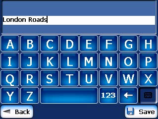
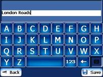
Add Group |
Create a new a group of roads to avoid. For example, you can create a group called San Francisco Roads, where you designate the roads in that area to be avoided. When you tap the Add Group button, the Avoid Roads Group screen appears. Enter the group name and tap Save. |
|
Edit Group |
Select a group and tap this button to change the group name. When you tap the Edit Group button, the Avoid Roads Group screen appears displaying the group name. Change the group name and tap Save. The new name is displayed on the Avoid Roads screen. |
|
Delete Group |
Select a group and tap this button to remove the group from the Avoid Roads screen. The road entries in this group are also removed. |
When selecting a group route, you
can tap the Allow

![]() or Avoid
or Avoid

![]() button to include or exclude all roads
located in the group.
button to include or exclude all roads
located in the group.
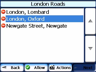
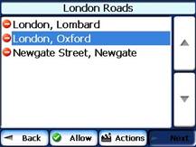
Avoid Road Locations
When you tap Default or an Avoid Roads group, Destinator displays the group screen, which lets you select roads to avoid. From this screen, you can use the Allow or Avoid buttons to include or exclude a selected road when calculating a route.
|
|
|
|
Figure 25 - Adding a Road to Avoid
Note: You cannot specify a particular toll road.
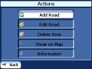
You can tap the Actions button from this screen to select from the following commands:
|
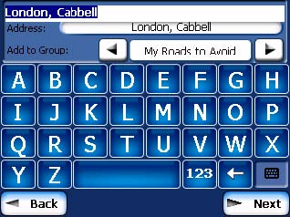
Add Road |
Lets you select a road. An address screen appears for you to specify a city and street. When you have completed updating your road information, tap Save. |
|
Edit Road |
Lets you rename the road and select a different group. When you have made your changes, tap Save. |
|
Delete Road |
Select a road and tap this button to remove the road from your group. Destinator no longer recognizes the removed entry as a road to avoid. |
|
Show on Map |
Lets you show the map with the displayed destination for you to review before creating a route. |
|
Information |
This button displays the locations address information. |
Route Playback
This feature lets you record your route as youre traveling and then to play it back on the Map screen. From the Options menu, tap the Route Playback button.
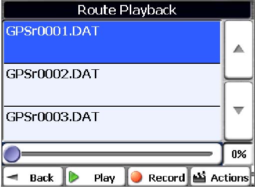
To record a route, tap the Record button in the Route Playback screen. Destinator DG shows the Map screen and navigates you to your selected destination. To stop recording, return to the Route Playback screen and tap the Stop button.
|
|
|
Figure 26 - Recording a Route
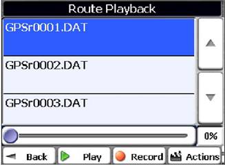
To playback your recording, select the data file, and tap the Play button. Destinator DG shows the Map screen to play the recorded route. To stop the playback, return to the Route Playback screen and tap the Stop button.
You can tap the Actions button to display the following commands:
|
Delete Recording |
This button lets you remove a selected recording. |
|
Clear All Recordings |
This button removes all recordings. |
|
Playback Speed |
Use the arrow keys to adjust the playback speed. The range is from 100% to 300%. |
Map Browsing
|
|
This feature lets you browse the map without the GPS receiver returning you to your current location. Tap the Browse the Map button to disconnect from the GPS receiver. |
5 - Settings
Map
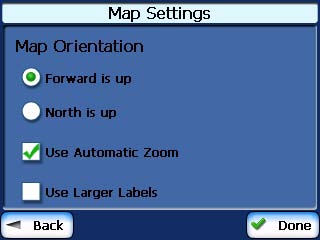
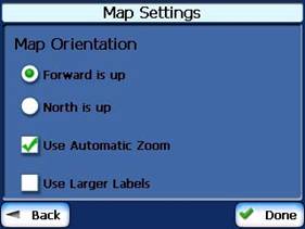
You can click the Map Settings button from the Settings menu to customize your map display, as shown in the figure below.
|
|
|
Figure 27 - Map Settings
The following map settings are:
|
Map Orientation |
Forward is up This option orients the map so that your forward direction is always at the top. North is up This option orients the map so that North is always at the top. |
|
Use Automatic Zoom |
When this option is selected, the zoom is speed dependent. The map zooms out at higher speeds, displaying a larger map area, and zooms in at slower speeds, displaying a smaller map area. If you manually change the zoom, the Automatic Zoom returns to its system level after several seconds of inactivity. |
|
Use Larger Print |
This option increases the size of street names to make the map easier to read. |
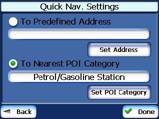
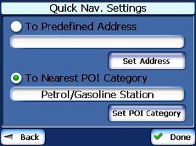
Quick Navigation
You can define the Quick Nav. location by
selecting either the To Predefined Address or To Nearest POI Category
in the Quick Nav. Settings screen. When the location is selected, you
can navigate to your address by tapping the Quick Nav.

![]() button displayed on the Map screen.
button displayed on the Map screen.
For example, if you have selected 'Gas Stations' as the Quick Nav. destination, when you click the Quick Nav. from the Map screen, Destinator automatically creates a route to the closest gas station.
|
|
|
Figure 28 - Setting the Quick Nav Location
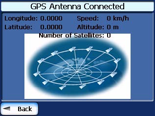
GPS Settings
Destinator DG uses the GPS receiver to pinpoint your location. GPS signals are automatically acquired and your vehicle's location and position are constantly updated unless you are working in the Browse Map mode. The GPS may take a few minutes to find its initial location. For best results, ensure that the GPS has a clear view of the sky.
|
|
|
Figure 29 - GPS Status
You can tap the GPS Status button from the Settings menu to display the following information:
Longitude - The angular distance east or west
on the earth's surface, as measured in degrees from the meridian of a
particular point to the prime meridian of
Latitude - The angular distance, measured north of south from the equator, of a point on the earth's surface.
Speed - The rate of movement, as expressed by kilometers or miles per hour.
Altitude - The height above sea level.
The green lines that appear on the satellite image represent the satellites that are sending GPS signals to your receiver.
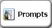
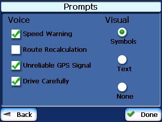
Prompts
You can select the types of voice and visual notifications that you would like to use while navigating. From the Settings menu, tap the Prompts button. The Prompts screen appears, as shown in the figure below.
|
|
|
Figure 30 - Prompts Settings
Voice Prompts
|
Speed Warning |
This prompt warns you when your car exceeds the speed limit. This prompt is not active unless selected. |
|
Route Recalculation |
This prompt is activated when Destinator recalculates a new route. This prompt is not active unless selected. |
|
Unreliable GPS Signal |
This prompt warns that the GPS signal is too low and unreliable for navigation. This prompt is automatically active. |
|
Drive Carefully |
This is a friendly reminder at the start of each journey. This prompt is automatically active. |
Visual Prompts
|
Text |
Directional prompts are displayed in written form. |
|
Symbols |
Directional prompts are displayed in diagram form, such as an arrow. |
|
None |
Directional prompts are not displayed. |
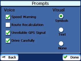
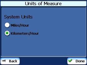
Units of Measure
From the Settings menu, click the Units of Measure button to specify the systems units of measurement.
|
|
|
Figure 31 - Units of Measure
You can select:
|
System Units |
You can select: Imperial Yards or miles Metric Meters or kilometers |
|
About |
This information box provides version and copyright information. |
Tutorial
|
|
From the Settings menu, you can tap the Tutorial button to open the Destinator Guide Tour program. The Guided Tour is an excellent way of becoming familiar with the different navigation features available. |
About
The About

![]() button lets you display Destinators
version and copyright information.
button lets you display Destinators
version and copyright information.
Help
The Help

![]() button displays the Destinator DG Help
file.
button displays the Destinator DG Help
file.
6 - Installation Requirements
Destinator DG is already installed on your proprietary device, but to add or change maps, you are required to install the Destinator DG Console on to your PC.
PC Requirements
To install and use the Console, your PC must meet the following requirements.
Microsoft Windows 98, ME, NT, 2000, or XP
Microsoft ActiveSync
A minimum of 300 MB free space for temporary files
An Internet connection for online registration
Installing the Console
To install the Destinator DG Console:
Insert the Destinator DG Disk into the PC's CD-ROM drive. The Destinator DG Console Installation Wizard prompts you to select the language used for the installation process. When you have selected a language, click OK.
Please read the Welcome message and click Next.
From the Select Directory screen, either accept the recommended default directory or browse to a different directory to install the Destinator DG Console. Click Next.
From the Language screen, select the default language. Click Next.
The Installation Confirmation screen displays your installation choices. If you are ready to install, click Next. The Installation Status box displays the progress of the installation process.
If you want to change the language selection or the directory location before installing, click Back, make your changes, and return to the Installation Confirmation screen, and click Next.
When the installation is complete, click the Finish button to close the wizard.
Console Toolbar
The following options are available from the Console Toolbar:
|
|
The Install Software button lets you install the Navigation System to your device. |
|
|
The Install/Remove Map button lets you install or remove a map. For more information, see Installing a Map on page 34. |
|
|
The Map Cutter button lets you customize an installed map. For more information, see Map Cutter Screen Interface on page 35. |
|
|
The Import Favorites button lets you download a list of your favorite locations from your PC to the selected My Favorites group on your device. |
|
|
The Quick Activation button lets you activate your Navigation System through an automated process. |
Technical Support
For answers to common questions and quick assistance see the Destinator FAQ for Registered Users online at: https://www.destinatortechnologies.com
If you have other questions about Destinator DG, please contact your supplier or Destinator Technical Support via email at support-eu@destinatortechnologies.com or telephone +44 (0)871 075 5110.
Technical support for the
+1 (866) 798-0905 toll free supportus@destinatortechnologies https://www.destinatortechnologies.com
7 - Maps
When you receive your device, Destinator DG is installed on your SD memory card along with a series of maps. This section provides information about installing additional maps from the Destinator DG Console. For information about installing the Destinator DG Console, see Installation Requirements on page 32.
Map Screen Interface
On the Destinator DG Console, a collection of maps is displayed.
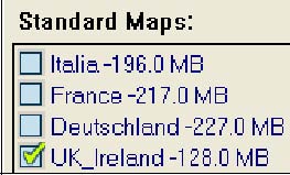
|
Standard Maps |
Maps available for installation from your CD. |
|
My Maps |
Maps that you have customized from a standard
map. For example, creating a map of |
|
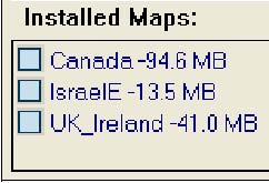
Installed Maps |
Current maps on your SD memory card. |
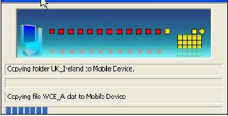
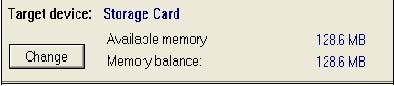
Installing a Map
You can install a map by selecting it from the Standard Maps pane in the Destinator Console and clicking the Install/Remove Maps button. The Target Device dialog box appears. Select Storage Card. The amount of memory available for the SD memory card appears on the Target Device Memory Balance pane. The installed map appears in the Installed Maps pane.
|
|
|
|
Figure 32 - Installing a Map
Map Cutter Screen Interface
Due to memory limitations of your SD memory card, you may want to customize a standard map by selecting the area you need. For example, if you are visiting a number of European cities on business, you may not want to install entire maps of those countries.
You can crop a standard map from the Destinator
Map Cutter screen. Select a standard map and click the Cut Map

![]() button. The Map Cutter screen appears, as
shown in the figure below.
button. The Map Cutter screen appears, as
shown in the figure below.
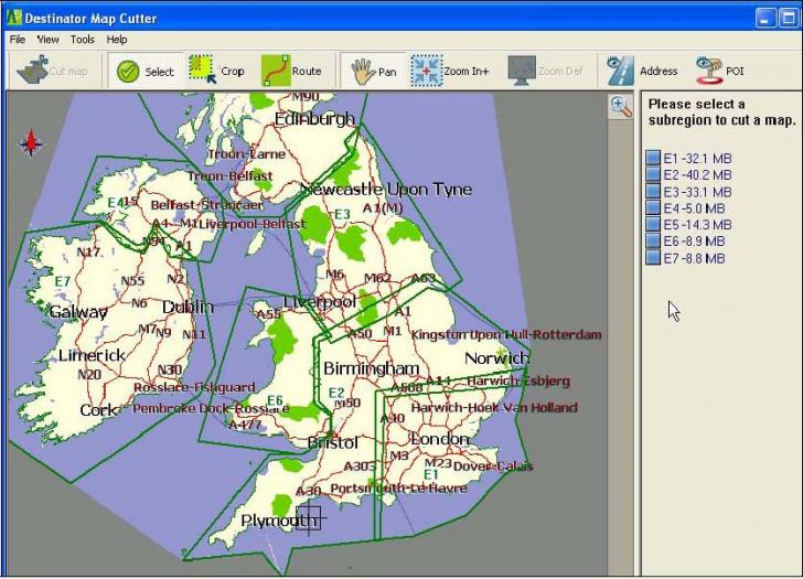
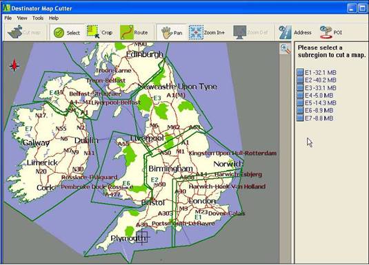
Figure 33 - Using the Map Cutter
The following tools are provided to help you easily move, view, and designate an area on the map:
|
|
You can use the Pan tool to move the map up, down, left, or right. |
|
|
You can use the Zoom tool to increase or decrease the map detail. You can also use the scroll bar to zoom in or out. |
|
|
You can use the Crop tool to designate an area on the map that you want to cut. When you have selected your focus by using the focus tools, as described below, click the Crop tool to designate an area on the standard map. |
|
|
You can use the Cut tool to create a customized map from your designated area. |
Focus the Map
The following tools are provided to help you
center your map, so you can designate the area that you want to cut. For
example, perhaps you want the
|
|
You can click the Address tool to set the origin of the map to a City, Street Address, or Intersection. The Address dialog box provides the Show and Set buttons to view and set the map focus. |
|
|
You can click the POI tool to set the origin of the map to a point of interest. The POI dialog box displays all categories in the left pane. When you click a category, the items associated with the category appear in the right pane. You can click the Show POI and Set POI buttons to view and set the map focus. |
|
|
You can click the Select tool to set the origin of the map by a predefined sub-region. A list of sub-regions is displayed in a pane to the right of the map. When you click a sub-region, that area is highlighted. |
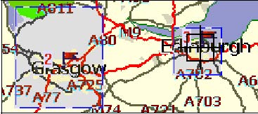
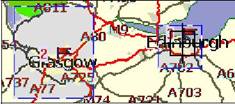
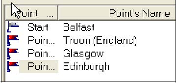
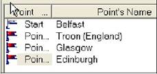
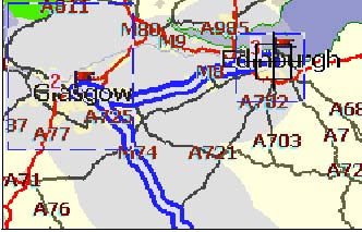
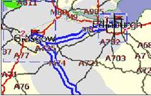
Focus the Map by Route
Destinator DG supports route cutting, which allows you to create a map composed of points on a route. To create the route, you must specify two or more points. After the route has been created, you can cut a map from your route specifications.
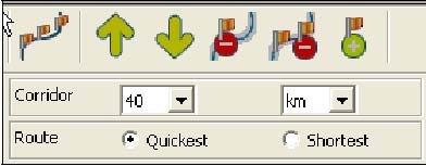
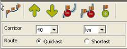
Click the Route tool. The Route
pane appears. Use the Address and POI tools to set route points. Click
the
|
|
|
|
|
Figure 34 - Create Map by Route
The following commands are described below:
|
|
Click this button to center the map on the selected point. |
|
|
Click this button to delete the selected point. |
|
|
Click this button to delete all selected points. |
|
|
Click these buttons to move a selected point up or down. |
|
Corridor |
You can select the amount of surrounding area that is included along the route's path, as measured in kilometers or miles. |
|
Route |
You can select either the quickest route, as determined by speed limit, or the shortest physical route. |
Cut Map
When you have designated your map area, click
the Cut Map

![]() tool. The Cut Map dialog box appears, as
shown in the figure below.
tool. The Cut Map dialog box appears, as
shown in the figure below.
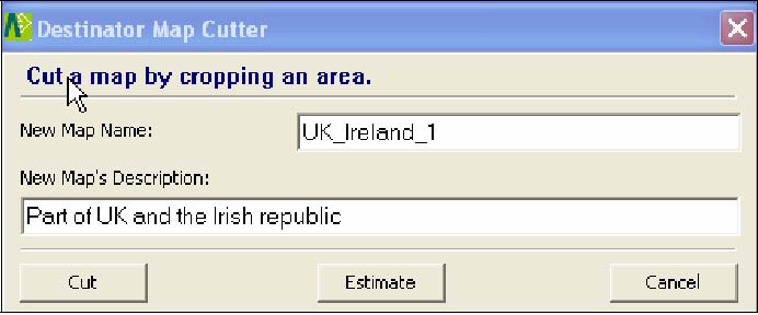
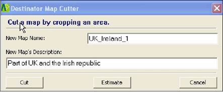
Figure 35 - Cutting a Map
You must enter a map name and description. If you have entered a name that already exists, Destinator DG prompts you to enter a different name.
You can click the Estimate button to display the map size. This is an important feature when memory space is limited.
Load Map
On the Destinator Console, you can refresh your maps by clicking Tools>Refresh New Map Data. Select the map that you wish to load by clicking on the map image or select it from the list. A checkmark represents a selected map.
From the Target Device pane, click the Change button to specify where to install the map. You can choose Removable Disk. After you have selected your target device and have confirmed that there's sufficient memory, click the Install/Remove Maps button. Your selected maps are installed and appear in the Installed Maps pane.
Remove Map
In the Target Device pane, click the Change button and select the location from where to remove the map. You can choose Storage Card. This updates the Installed Map pane.
The Installed Map pane displays a list of all the loaded maps available. Select the check box by the map you want to remove. Click the Install/Remove Maps button to remove the selected map.
8 - Importing a Favorite
You can download a list of favorite locations from your PC to your device. The list must be contained in .csv files. As part of the download procedure, you convert the .csv files to .dat format for storage on your device by using the Destinator Conversion utility.
Favorites Importing File Structure
The Favorites Importing file structure must be in .csv (Comma-Separated Values) format.
The file contains the following fields:
1. Name of favorite
2. Comment
3. Longitude
4. Latitude
5. ZIP Code
6. City
7. Street
8. House number
The Longitude and Latitude are numerical values. All the others are string values. If a string value contains a comma, the field must have quotation marks.
Examples:
|
Name |
Comment |
Long. |
Lat. |
Zip Code |
City |
Street |
House Number |
|
Favorite place 1 |
Destinator Favorites Converter Comment 1 |
|
|
|
|
Ariboweg |
|
|
Favorite place 2 |
Destinator Favorites Converter Comment 2 |
|
|
|
|
Moutstraat Weg |
|
|
Favorite place 3 |
Destinator Favorites Converter Comment 3 |
|
|
1096 |
|
Joop Geesinkweg |
|
|
Favorite place 4 |
Destinator Favorites Converter Comment 4 |
|
|
|
|
Rue Danton |
|
|
Favorite place 5 |
Destinator Favorites Converter Comment 5 |
|
|
|
|
Frits Weg |
|
The .csv file contains the values in a table as a series of ASCII text lines, organized so that each column value is separated by a comma from the next column's value and each row starts a new line.
Importing a .CSV File
To import a .csv file:
On the Destinator Console, click on a Standard Map. This will enable the Installing Map and Favorites Importer features.
Click the Favorites Importer button. The Converter dialog is displayed.
Select the .csv file, specify a category name, and click the Convert button. The Report Area displays a message stating that the content of the file has been converted and that the file is ready for download.
Download the file to your device by clicking the Download button.
9 - System Settings
|
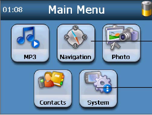
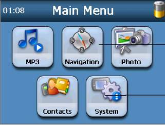
|
Figure 36 - The Main Menu
You can change the system settings by tapping the System button. The System screen shows all of the system settings that you can change, as displayed below.
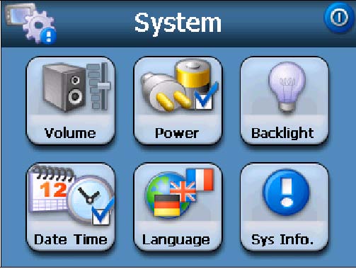
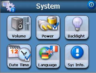
Figure 37 - System Settings
You can tap the Back

![]() button to return to a previous screen.
button to return to a previous screen.
Starts the Destinator DG application
Opens the devices System Settings screen

![]()

![]()
Volume Settings
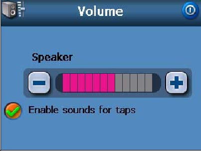

Figure 38 - Volume Settings
This screen lets you change the volume level for voice prompts and tap sounds.
Power Settings
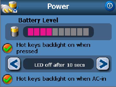
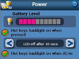
Figure 39 - Power Settings
This screen indicates the battery status of the device.
You can select the hot key checkboxes to determine whether you want the backlight for the device keys.
Backlight Settings
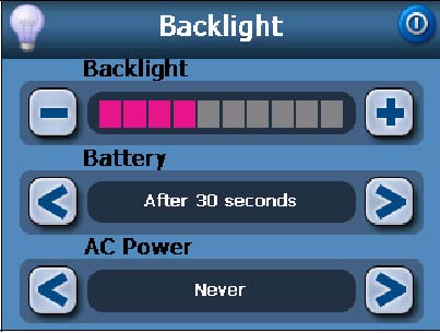
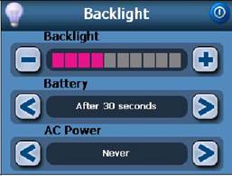
Figure 40 - Backlight Settings
This screen lets you determine the brightness of the screen. You can save power by selecting how long the backlight will stay on before it dims when running the device either on battery or on AC power.
Date-Time Settings
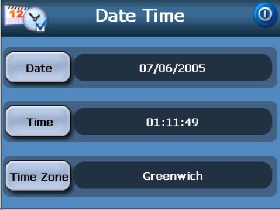
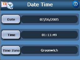
Figure 41 - Date-Time Settings
This screen lets you select your time zone, and to set the date and time.
Language Settings
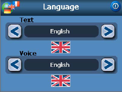

Figure 42 - Language Settings
This screen lets you select the language to be used for screen displays and voice prompts.
System Information
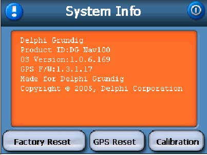
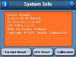
Figure 43 - System Information
This screen displays information about the device.
Index
A
About 31
Address 11
Address Actions 13
Address Modes 12
Avoid Road Groups 25
Avoid Road Locations 26
Avoid Roads 8, 25
B
Backlight Settings 42
C
Cancel Route 20
Comma-Separated Values 39
CSV See Comma-Separated Values
Cut Map 38
D
Date-Time Settings 43
Defining the Route Groups 24
Destination Menu 7
Destinator DG Features 3
Destinator Technologies 3
E
Enter Address
F
Favorite Groups 16
Favorite Locations 17
Favorites' Alert 16
Focus the Map 36
Focus the Map by Route 36
G
Gas, Food, Lodging 7
General Settings 9
Getting Started 4
Go to your Destination 13, 15, 18
GPS Not Found 5
GPS Status 9, 29
H
Help 31
I
Installation Requirements 32
Installing a Map 33, 34
Installing the Console 32, 33
L
Language Settings 43
Load Map 38
M
Map Browsing 27
Map Cutter Screen Interface 35
Map Preferences 9
Map Screen Interface 34
Map Settings 28
Map Views 5, 8
Maps 34
Menus 7
Multistop Planner 23
My Favorites 7, 13, 14, 15, 20
O
Options Menu 8
P
PC Requirements 32
Plan a Trip 23
POI Actions 20
POI Convertor 40
Point on the Map 6
Power Setting 42
Prompts 9
Q
Quick Nav. Settings 29
R
Recent Locations 7, 14
Remove Map 38
Route Overview 20
Route Planner 8
Route Playback 8, 27
S
Screen Buttons 9
Search for a Location 11
Search Near a Location 19
Select Map 7, 22
Set Quick Navigation 9
Setting Stops Along the Route 24
Settings Menu 9
Stops Actions 25
System Information 43
System Settings 41
System Units 31
T
Technical Support 33
Turn-by-Turn 7
Tutorial 3
Tutorial Settings 31
V
Volume Settings 42
W
What's on the Map 4
Working with a Navigation list 10
|
Politica de confidentialitate | Termeni si conditii de utilizare |

Vizualizari: 1740
Importanta: ![]()
Termeni si conditii de utilizare | Contact
© SCRIGROUP 2026 . All rights reserved